
iTwin Capture Modeler (formerly ContextCapture)

Reality modeling is the process of capturing the physical reality of an infrastructure asset, creating a representation of it, and maintaining it through continuous surveys. Bentley's reality modeling software, iTwinCapture, provides you with real-world digital context in the form of a 3D reality mesh.
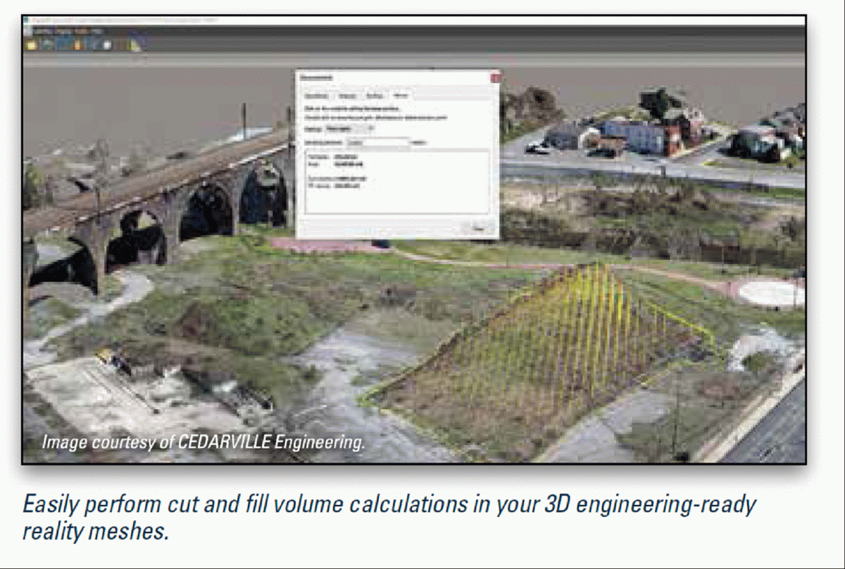
A reality mesh is a 3D model of real-world conditions that contains large amounts of triangles and image data. Each digital component can be automatically recognized and/or geospatially referenced, providing you with an intuitive and immersive way to navigate, find, view, and query your asset information. You can use reality meshes in many engineering, maintenance, or GIS workflows to provide precise real-world digital context for design, construction, and operations decisions.
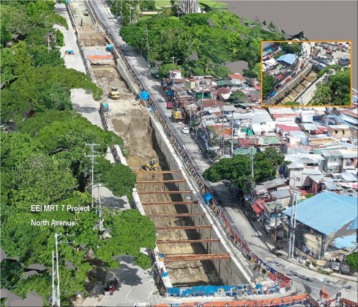
Overlapping photos from drones and ground-level imagery, supplemented by laser scans where needed, iTwinCapture enables you to generate spatially-classified and engineering-ready reality meshes at any desired level of accuracy and scale, including an entire city.
If you are working on an individual desktop computer and you have projects that require less than 300 gigapixels of imagery and/or 3 billion points from a laser scanner, iTwinCapture is the perfect solution. If your projects are larger, and you wish to utilize multi-engine parallel processing to speed the production of your reality model, iTwinCapture Cloud Processing Service or iTwinCapture Center are perfect for your needs.
iTwinCapture also comes with a free iTwinCapture Viewer, so you can easily explore and precisely measure reality meshes of any scale.
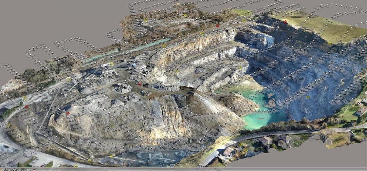
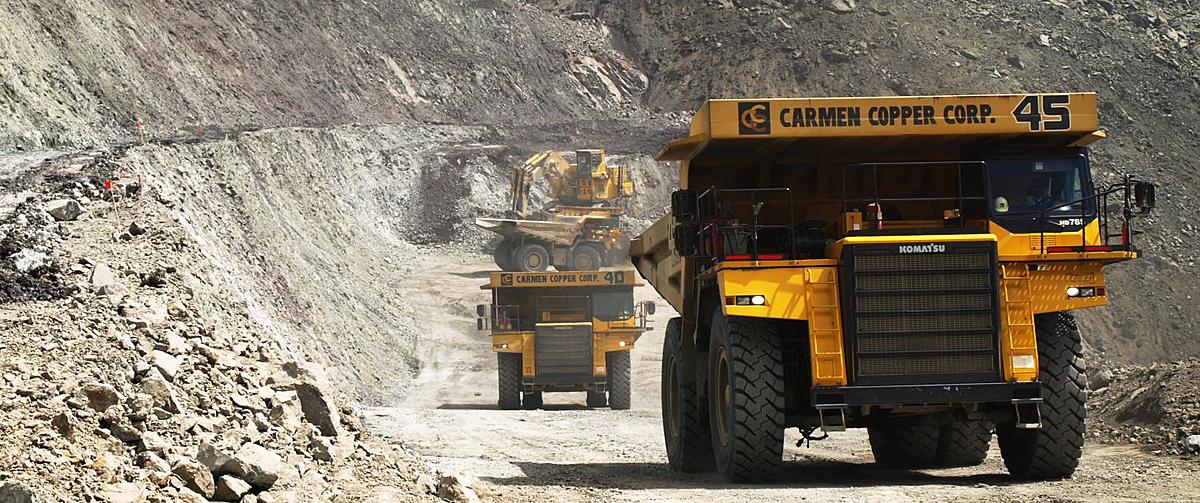
Regular monitoring progress of a mine site using a drone to capture photographs that allows rapid volumetric calculations and mine-site planning